
Open User Map
Open User Map is the premium WordPress plugin for creating interactive, user-driven maps with frontend submissions and approval workflows.
Visit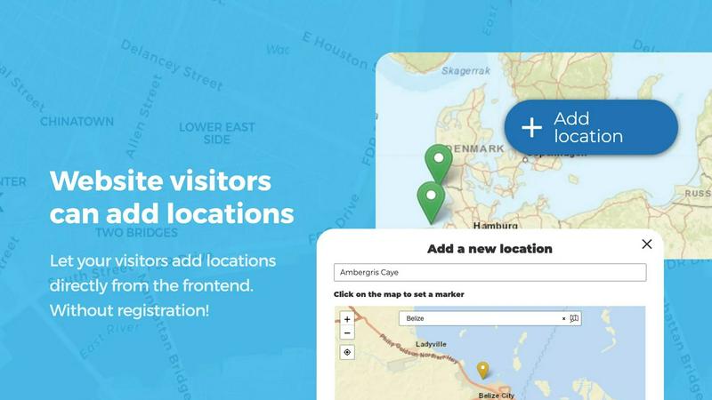
About Open User Map
Open User Map is a premium interactive mapping solution for WordPress that empowers website owners to create dynamic, community-driven maps without any coding knowledge or complex technical setup. This sophisticated plugin eliminates the traditional barriers associated with map integration, such as requiring a Google Maps API key or navigating intricate configuration processes. Instead, Open User Map offers a seamless, turnkey experience that transforms any WordPress site into a collaborative mapping platform. The core value proposition lies in its ability to allow website visitors to contribute locations directly through a frontend interface, complete with an approval workflow that gives administrators full control over published content. Designed for businesses, organizations, and community platforms of all sizes, Open User Map serves as a powerful tool for collecting, organizing, and displaying geographic data in a visually compelling manner. With over 15,000 active installs and a perfect 5-star rating, it has established itself as the premier choice for WordPress users seeking a robust, user-friendly mapping solution. The plugin caters to a diverse audience ranging from local business directories and tourism websites to event organizers, real estate platforms, and community groups. Its extensive customization capabilities, including custom fields, marker categories, and advanced filtering, ensure that each map can be tailored to meet specific project requirements. By democratizing the map creation process and enabling community participation, Open User Map elevates the standard WordPress mapping experience to an elite level of functionality and engagement.
Features of Open User Map
Frontend Location Submissions and Editing
Enable your website visitors to add and edit locations directly on your map through an intuitive frontend interface. Clicking the 'Add location' button allows users to place a marker and submit detailed information, which then awaits your approval before becoming publicly visible. This feature streamlines data collection and encourages community participation while maintaining quality control. Additionally, users can edit their existing submissions, ensuring the map always reflects the most current and accurate information without burdening administrators.
Advanced Marker Categorization and Filtering
Organize your map with sophisticated marker categories, each distinguished by unique icons and visual styles. This powerful organizational system allows visitors to filter locations based on specific criteria, making it effortless to find relevant information. Each location can belong to multiple categories, ensuring comprehensive representation of all attributes. The result is a clean, intuitive map layout that enhances user experience and helps visitors quickly identify points of interest that matter most to them.
Lines and Areas Mapping
Go beyond simple point markers by adding routes, paths, zones, and regions directly to your map. This feature enables you to highlight trails, service areas, event grounds, neighborhoods, construction zones, or any custom shape that provides immediate visual context. Distances and area sizes are calculated automatically, so routes and polygons include helpful measurements right out of the box. This capability transforms your map from a simple location display into a comprehensive spatial visualization tool.
Custom Image as Map
Upload any image and transform it into a fully interactive map, whether it is an overlay, floor plan, event layout, game map, product diagram, campus guide, or seating chart. Users can place markers directly on top of the image with the same powerful functionality as a traditional geographic map. This feature supports adding locations, displaying custom fields, enabling filtering, and creating an engaging, clickable experience tailored exactly to your specific use case.
Advanced Filter Interface
Create a filter sidebar that appears next to your map, allowing visitors to filter locations by any custom field you have configured. This interface provides a streamlined way for users to narrow down results based on specific criteria. You can also add custom HTML content sections to display additional information or branding, giving users a clearer, more intuitive way to explore your mapped data. The advanced filter interface enhances discoverability and user engagement significantly.
Flexible Custom Fields
Enhance your map with tailored custom fields including text boxes, links, checkboxes, and dropdowns to suit your specific data collection needs. This feature allows you to gather exactly the information you require from map interactions, making your data collection as comprehensive and user-specific as possible. Custom fields integrate seamlessly with the submission and filtering processes, providing a complete solution for capturing and organizing location data.
Use Cases of Open User Map
Local Business and Service Directories
Create a comprehensive directory where local businesses can add their locations, hours of operation, contact information, and services offered. Visitors can easily search and filter by category, rating, or custom fields to find exactly what they need. The approval workflow ensures only verified businesses appear on the map, while the star rating and upvote features help highlight the best establishments in the community.
Tourism and Travel Guides
Build an interactive travel guide where visitors can discover points of interest, restaurants, hotels, and attractions. Use the Lines and Areas feature to highlight walking trails, scenic routes, or neighborhood boundaries. Enable users to contribute their own discoveries and reviews, creating a living, evolving resource that stays current with the latest recommendations and hidden gems.
Event Planning and Venue Management
Design maps for festivals, conferences, or large-scale events showing vendor locations, stages, restrooms, parking areas, and emergency services. The Custom Image as Map feature is particularly valuable for converting venue floor plans or site layouts into interactive guides. Attendees can filter by category to find food vendors, restrooms, or specific activities, enhancing their overall event experience.
Real Estate and Property Listings
Showcase available properties with precise location markers, detailed information through custom fields, and high-quality images. Potential buyers can filter by property type, price range, number of bedrooms, or any other relevant criteria. The frontend submission capability allows real estate agents to add new listings directly, while the approval workflow ensures only qualified properties are displayed to prospective clients.
Frequently Asked Questions
Do I need a Google Maps API key to use Open User Map?
No, you do not need a Google Maps API key. Open User Map operates independently of Google Maps, eliminating the complexity and potential costs associated with API key management. The plugin uses its own mapping infrastructure, making setup straightforward and hassle-free. This is one of the key advantages that distinguishes Open User Map from other mapping solutions.
Can I try the PRO version before purchasing?
Yes, you can start a 7-day free trial of the PRO version with no credit card required. The trial gives you full access to all premium features, and it does not automatically convert into a paid subscription after the trial period ends. You can cancel at any time during the trial with no commitment, allowing you to thoroughly evaluate the plugin before making a decision.
How does the approval workflow for user submissions work?
When a visitor submits a location through the frontend interface, it is placed in a moderation queue for your review. You can approve, edit, or reject submissions before they become publicly visible on the map. This gives you complete control over the content that appears, ensuring accuracy and relevance. You can also customize notification settings to receive alerts when new submissions are waiting for review.
Can I customize the appearance and functionality of my map?
Absolutely, Open User Map offers extensive customization options. You can choose from multiple map styles, customize marker icons and colors, create custom fields for location data, set up advanced filtering interfaces, and even use custom images as map backgrounds. The plugin is designed to be highly flexible, allowing you to create a map that perfectly matches your brand and meets your specific requirements.
Similar to Open User Map

Built2WinWeb AI SEO
Custom PHP websites, AI Indexing Pack ($599 one‑time), and WebAgentScan SaaS ($9/mo). MCP, A2A, llms.txt, full ownership.
PDF Pro AI
Privacy-first AI document tool — analyze medical reports, bank statements & salary slips 100% in-browser. No uploads, no signup, free.
Unifyca
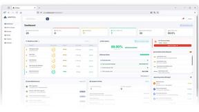
Unifyca gives elite agencies unified control over every client WordPress site with centralized documentation, automated audits, and seamless backups.

Any2URL
Any2URL instantly transforms any image into a shareable public link for effortless pasting anywhere.
Shadcn Examples
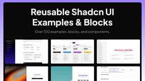
The premier collection of production-ready Shadcn UI blocks and examples for building professional React and Tailwind web applications.
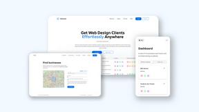
Webleadr
Effortlessly discover and contact businesses without websites worldwide, transforming leads into loyal web design clients in just a few clicks.

Idearium
Idearium crafts exceptional websites and marketing strategies that elevate brands and drive meaningful business growth.
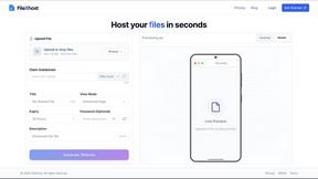
FilexHost
Effortlessly host and share your files with instant URLs using FilexHost's simple drag-and-drop interface.